Tourist Attractions in Kisoro
The Virunga Volvanoes
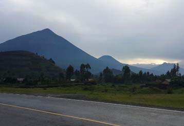 Straddling the boarder of Uganda, Rwanda and DRC, the Virungas are not a mountain range as such, but a chain od isolated freestanding volcanic cones strung along a fault line associated with the same geological process that formed the rift valley. Sometimes also referred to as the Birunga or Bufumbira mountains, the chain is comprised of six inactive and two active volcanoes, all of which exceed 3,000m in altitude, the tallest being Karisimbi 4,507m, Mikeno 4,437m and Muhavura and Gahinga 3,475m straddle the Rwanda border, while Sabinyo 3,669m stands at the junction of the three national borders.
The vegetation zones of the virunga correspond closely with those of other large East African mountains, albeit that much of the Afro-Montane forest below the 2,500m contour has been scarified to cultivation. Between 2,500m and 3,500m where an average annual rainfall of 2,000m is typical, bamboo forest is interspersed with stands of tall hagenia woodland.
At higher altitudes, the cover of Afro-alpine moorland, grassland and marsh is studded with giant lobelia and other outsized plants similar to those found on Kilimanjaro and the Rwenzori. The most famous denizen of the virungas is the mountain gorillas, which inhabits all six of the extinct or dormant volcanoes, but not for obvious reasons, the more active ones.
The virungas also form the main stronghold for the endangered golden monkey, and support relic population of elephant and buffalo along with typical highland forest species such as yellow backed duicker and giant forest hog. The mountain avifauna is comparatively poorly known, but some 150 species are recorded including about 20 albertine Rift Endemics.
Lake Kagezi – along Kisoro – Kabale road
 In 1910, Captain Coote was dispatched to the far southwest of Uganda to establish the first British government station in the region.
He built the station next to a lake called Kagezi, a site that would be abandoned two years later in favour of Ikumba near Ruhija along Kabale – Kisoro road. It would eventually be applied formally to the southwestern administrative district of Uganda.
The original Kigezi was divided into two administrative components and in 1980 it was further subdivided and renamed to become the present day districts of Kabale, Kisoro, Kanungu and Rukungiri. The name Kigezi thus has little historical validity and it has also fallen into official disuse. Nevertheless most locals still refer to the above four districts collectively as Kigezi.
Lake Kagezi is situated only 800m from Kisoro – Kabale road along a rough track leading north from alongside a conspicuous church. Lake Kagezi is little more than a grassy seasonal swamp set in an approximately circular small depression, possibly an extinct crater and no more than 200m in diameter.